GREENWICH FESTIVAL 1977
GREENWICH TOWN CENTRE WALK By Barbara Ludlow
Introduction by Julian Watson
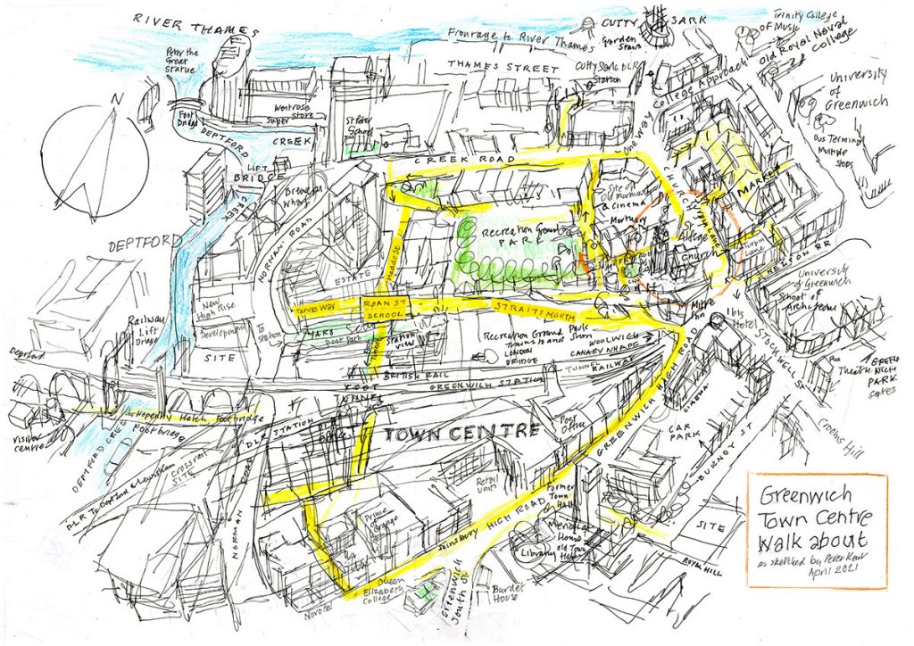
Barbara Ludlow (1929-2016), former President of our society, was a gifted social historian with a fascination for aspects and areas of Greenwich, like Greenwich Marsh (the Peninsula) and East Greenwich, which hadn’t attracted the interest of historians or visitors to the town. The town centre and its fringes including the West Greenwich marshes adjoining Deptford Creek, hadn’t featured in any Greenwich histories or guide books. The marshes remained undeveloped until the 19th century. This event during the Greenwich Festival of 1977, was and remains, unique. Barbara walked and researched the area then produced typed notes, which were photocopied for those who accompanied her on Friday 17th June. I was with her on that memorable walk. There have been changes to the town centre and its back streets since the walk, but Barbara’s notes are a ‘snapshot’ of the area as it was in 1977. Barbara’s typescript has been converted to an editable format, and a few notes in square brackets added for clarity. We have also added illustrations. We intend to publish and print a revised and updated version of this walk. Many thanks to Anthony Cross, John Bold and Rob Powell for their contributions and advice. Rob Powell has produced this blog for our website. We are most grateful to Peter Kent for the wonderful map, and to Museums Collections and Archives, Royal Greenwich Heritage Trust (RGHT) which holds the originals of many of the historic images that we have used.

Barbara Ludlow’s 1977 text begins here:
The district, which the walk covers, was once part of the town centre of Greenwich. Due to bombing, demolition for re-development and the removal of the seat of local government from West Greenwich to Woolwich, the majority of the streets we will tread are now ‘back-streets.’
Even the main roads are no longer the busy shopping and commercial areas they once were.
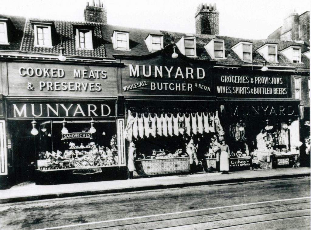
in Greenwich High Road before the bombing of World War II. RGHT.
Greenwich is now known as a tourist centre rather than a bustling town.
However, a walk along the roads lying to the west of St Alfege’s Church is rewarding. The character of an old town can be savoured and happily many interesting buildings survive.
This is a route the tourist does not take. On leaving the vicinity of St. Alfege’s Church there are no grand buildings by Inigo Jones, Sir Christopher Wren and Sir John Vanbrugh to be seen but many of the buildings we will pass are all part of the fabric, which still makes the ‘back-streets’ of Greenwich so interesting.
After a brief slide show in St. Alfege’s Parochial Hall (originally The National School of Education and Industry for Girls, 1814) the walk starts in St Alfege Passage, called ‘Church Passage’ until 1938.
South side
St. Alfege’s Church. Designed by Nicholas Hawksmoor between 1711 and 1718. Tower added by John James 1730.
North side
Entrance to St.Alfege’s Recreation Ground. This small park was laid out towards the end of the 19th century in Greenwich Churchyard, which had been closed by 1869.
Nos.6-11 St.Alfege Passage: A terrace built between 1844 & 1851.
At the end of the passage turn left into Greenwich Church Street. Look across to the East Side.
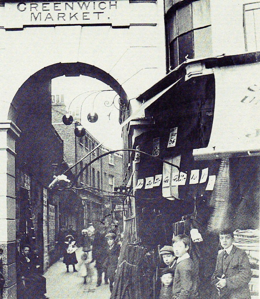
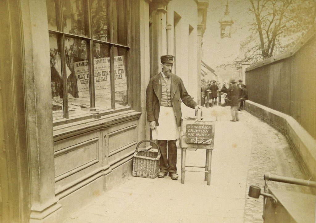
Greenwich Market and King William Walk. A pawnbrokers sign hangs over the lane. RGHT.
Entrance to Turnpin Lane (Inscription over entrance reads ‘Greenwich Market’).
This is a remnant of one of the older Greenwich streets, although rebuilt about 1830. Now mainly used by antique dealers, it once catered for household needs.
No. 10 [Greenwich Church St]. (Horatio’ s Restaurant). Frontage altered but one of the old shops of Greenwich. From about 1866 to about 1940 it was a pawnshop.
Nos. 12 and14 [Greenwich Church St]. Possibly mid-C18 fabric but with mid-C19 frontage.
No.16. Early C19. Nos.24-42. Built 1831 as part of Joseph Kay’s design for Greenwich Market.
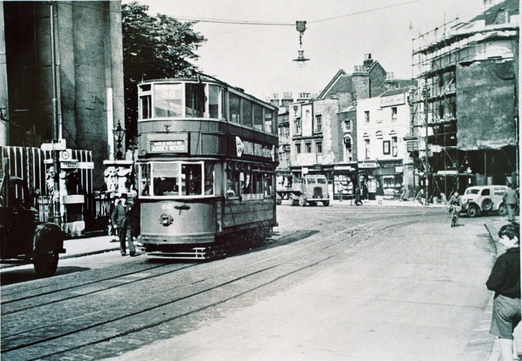
and the junction with Nelson Road on the right are clearly shown. RGHT.
In Greenwich Church Street to the north of College Approach (laid out in 1836 as Clarence Street) is the Gipsy Moth IV Public House. This was formerly the ‘Wheatsheaf’, described as ‘an old inn’ in 1925 as having ‘an antiquated rough-cast frontage, a swing signpost and old-fashioned outer lamp.’ Building much altered.
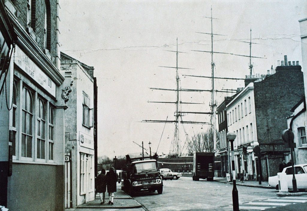
The Garden Stairs end of Greenwich Church Street has been completely changed this century. Old houses were demolished to make way for the entrance to the Greenwich Foot Tunnel, 1902 and, on the site of the famous ‘Ship Hotel,’ is the dry-docked Cutty Sark, brought to Greenwich in 1954.
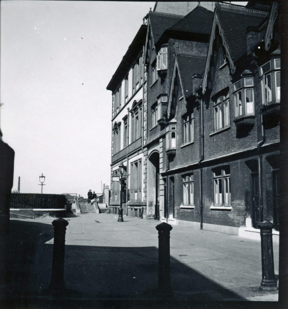
West side (Route of walk):
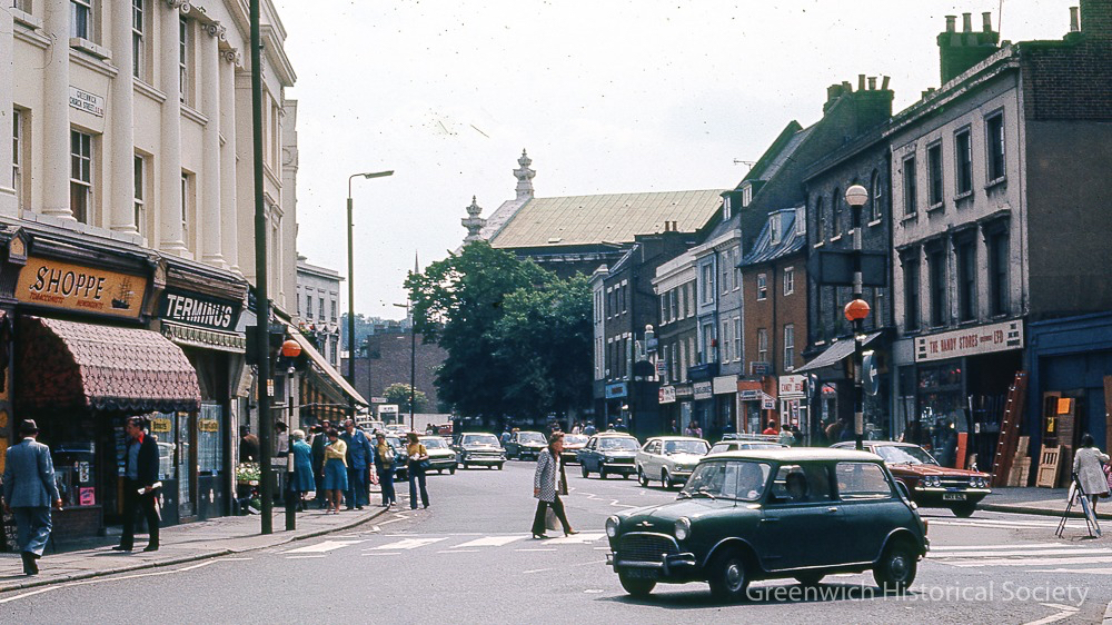
No.3 (Corner of St.Alfege Passage and Greenwich Church Street). Early C18. From about 1795 to 1920 this building was the Eight Bells Public House.
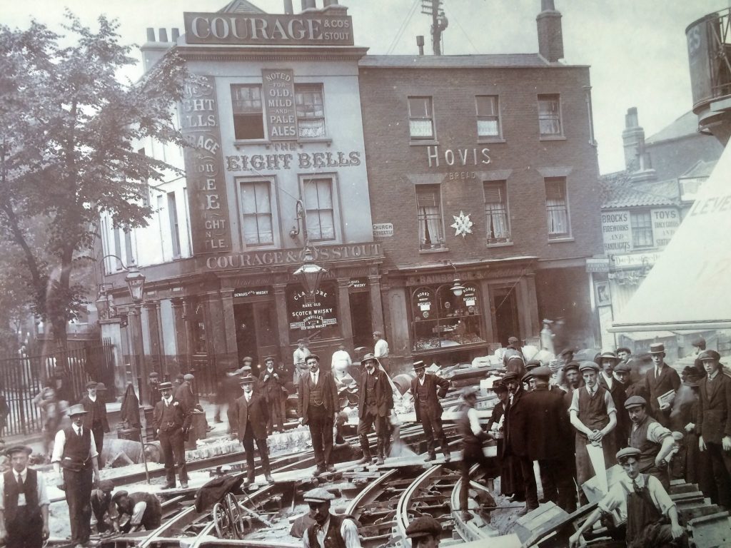
The interesting early 18th century pub is now a betting shop. Warwick Leadlay Gallery.
No.5 Early C19. Site of the Court of Requests (Removed to Stockwell Street at the beginning of the 19th century). This old court was used for the recovery of debts not exceeding £5.
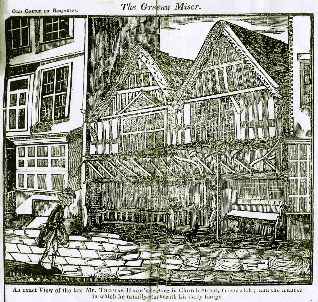
Nos.7 and 9. Early C19. This was the site of the medieval house of Thomas Hack, the ‘rich’ Greenwich Miser who died in the Parish Workhouse in 1813.
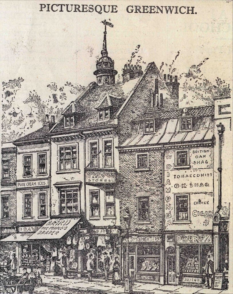
Nos.11-21. The oldest buildings in Greenwich Church Street. Very early C18 but nos. 11 and 13 possibly second half of the 17th century.
The Empire Cinema stood on the corner of Greenwich Church Street and Creek Road (formerly Bridge Street) from 1914 to about 1940. The cinema was at first entered through no. 27 Church Street but later the entrance was removed to No. 33. The shape of the entrance and the outline of the cinema can still be seen.
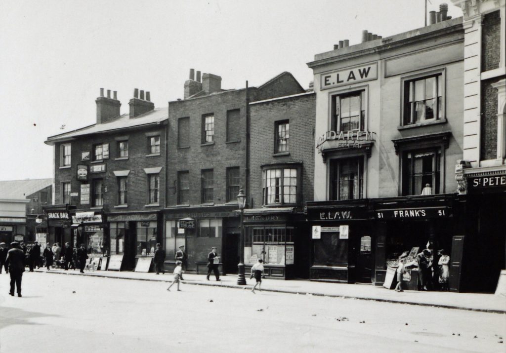
The Empire Cinema is just visible on the extreme left. Photo by AR Martin 1937. RGHT.
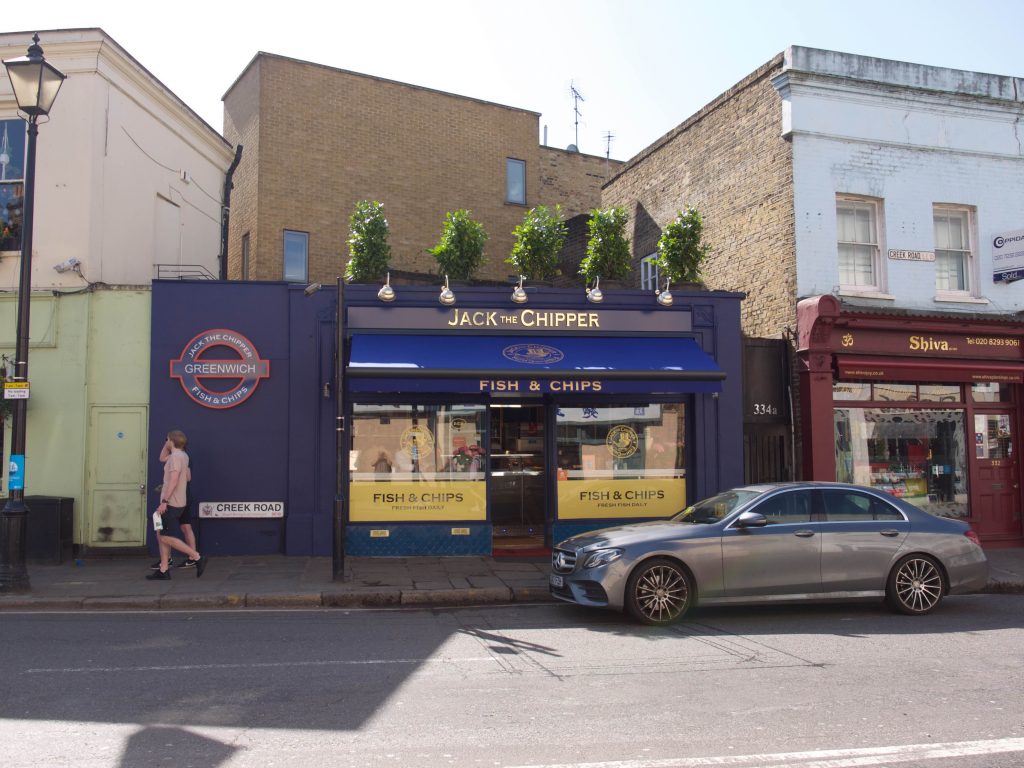
Proceed left (same side) into Creek Road.
This road was made at the beginning of the 19th century to connect Greenwich to Lower Deptford. At the same time the first Creek Bridge was constructed.
North side
St Peters School [now St Alfege with St Peter Primary School]. Built in 1867. Edgar Wallace started school here when he was known as Dick Freeman. (Still a school)
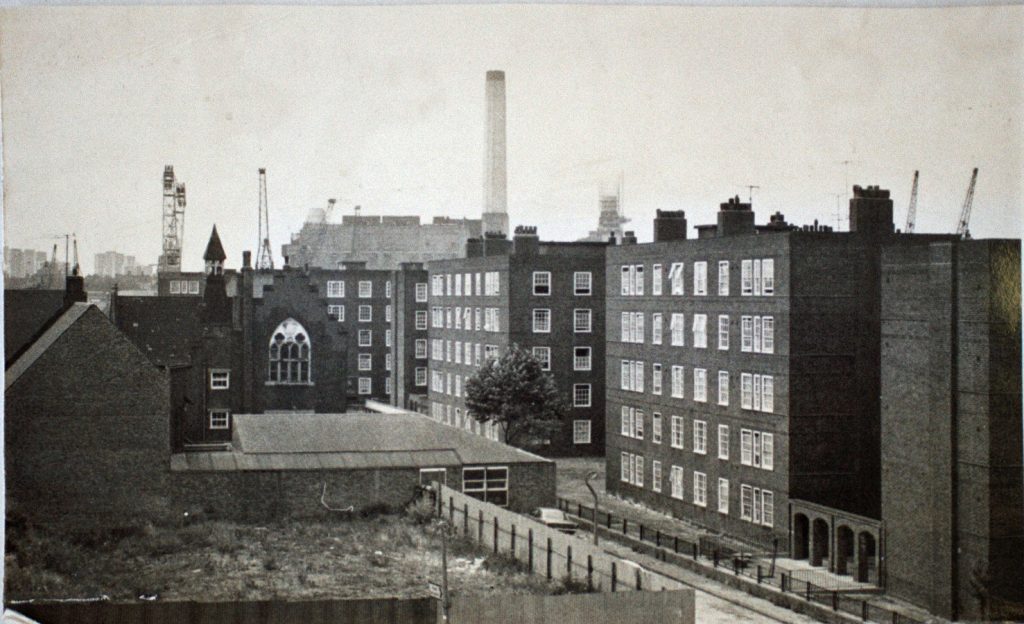
[Edgar Wallace has been described as ‘one of the most prolific thriller writers of [the 20th century’]
South side
No. 302. Originally St Peters Infants School. Built 1867. (Now used commercially).
(These two buildings not on route of walk).
Turn in first left into Bardsley Lane (formerly Lamb Lane).
North side
(Boundary of the old churchyard)
No. 22 built c.1900 as the Office of Weights and Measures. Built for the London County Council.
No. 2O. Built c.1902. Coroners Court. (Now Fuller Hills)
[Fuller Hills Ltd was a joinery works]
Back of No. 20. 1904. Mortuary. Architect Alfred Roberts of Greenwich (also Fuller Hills).
N.B.
These three buildings are on land once occupied by the old St Alfege Vicarage and its garden.
The Old Mortuary. 1881. Entrance from churchyard. (Now Fuller Hills)
Towards the end of the lane was the Central Sunday School c.1852. (Also used by Fuller Hills).
This lane, not a pretty sight now, was once lined on the north side by small houses and cottages. It is named after the Rev. Martin Bardsley, Vicar of St.Alfege’s Church at the beginning of the 20th century.
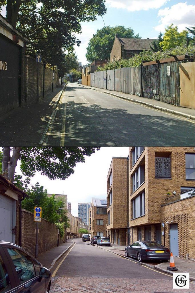
302 Creek Rd. The bottom photo shows new development in 2020. Photos by Julian Watson
Pause at the end of Bardsley Lane and look towards the River Thames and the Creek.
The modern Creek Bridge, 1954, can be seen. Deptford West Power Station: demolition taking place but almost complete. The famous Sebastian de Ferranti power station, built 1889, completely demolished. Deptford East Power Station left.
Factories such as The Phoenix Gas Works (later the South Metropolitan Gas Co.), The Thames Ironworks Shipbuilding Co. and the General Steam Navigation Co. were situated in this area.
Now turn left from Bardsley Lane into Haddo Street.
Keeping on the same side of the street continue past the Bell Public House (which marks the site of the entrance to Bell Street, now demolished) to Roan Street. On the corner is the Greycoat Boy Public House.
Turn left (same side):
No. 46. Grey Coat School and School House. 1808. (The Roan Charity).
‘Mr John Roan, in the year 1643,left an estate in houses near the church here, of £95 per annum…for teaching 20 boys reading, writing and arithmetic… these wear greycoats’.
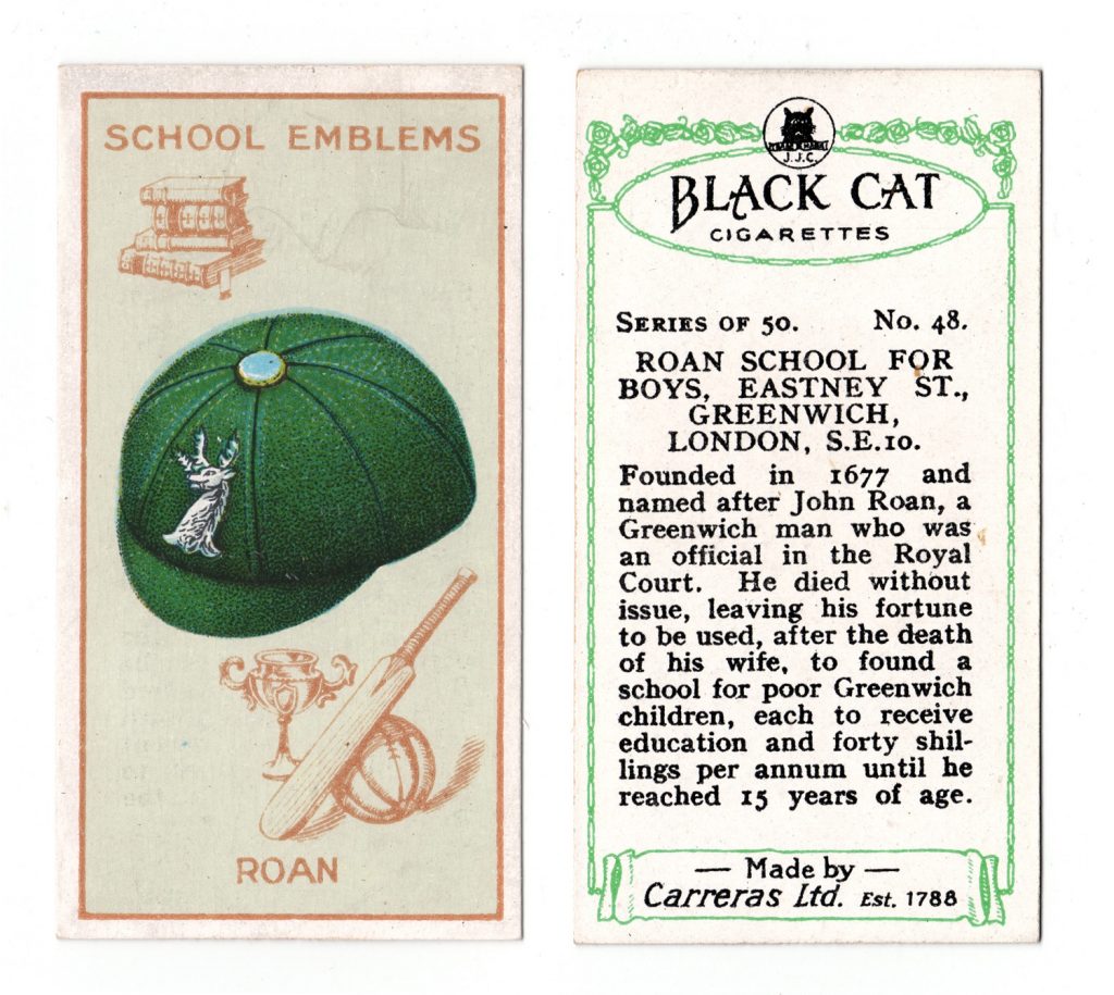
The School.
One floor only. Plaque removed from centre to side of building.
The School House. Externally not much alteration. Altered inside. Now Saxonia Electrical Wire Co.)
N.B. This was the second Greycoat School. The first building stood on the site of the Seamen’s Hospital garden.
Nos.44-36 Complete terrace. 1846.
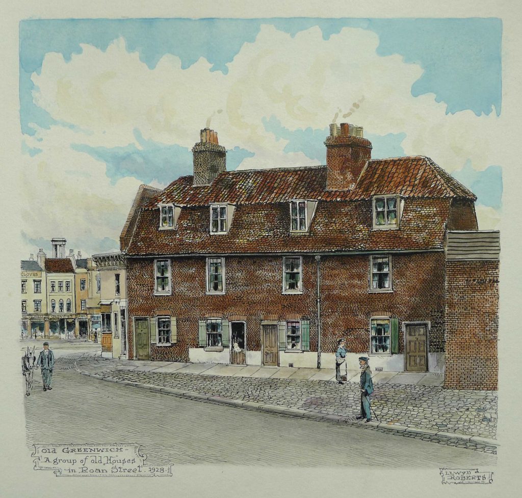
Proceeding in the same direction, cross to the other side of Roan Street where it joins Churchfields. This small street was part of Straightsmouth. Inscription on the wall reads ‘Brunswick Place, Straightsmouth.’
No.2 (Corner) Early C19 Once a Marine Store Dealers shop. (In Spurgeon photo of 1885)
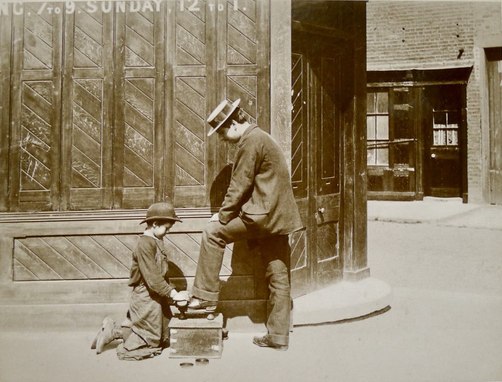
Nos.4-18 Early C19.
Walk along Churchfields to the junction of Randall Place and Straightsmouth. Cross the road to Straightsmouth.
The majority of the houses in Straightsmouth are C19 and because of the care taken in recent years this is an attractive street to walk down. Notice the ‘New Iron Room’ Gospel Hall at the entrance to Straightsmouth (Plymouth Brethren).
Cross the road to the north side and walk into Glaisher Street, named after Henry and James Glaisher (Balloonist). Glaisher Street exists in name only now but it leads to a ‘temporary’ Greater London Council open space which allows for a pause on the walk and a chance to see the backs of houses in Straightsmouth, a view of Greenwich Station and the back of the Williamson Memorial Hall (1865) in Randall Place.
STRAIGHTSMOUTH THEN AND NOW
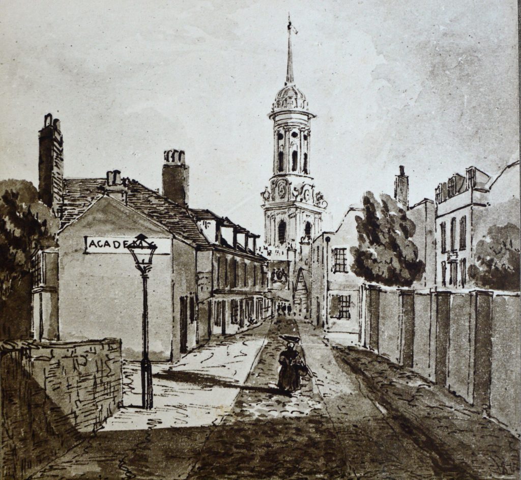
Copy of a drawing in the British Library.
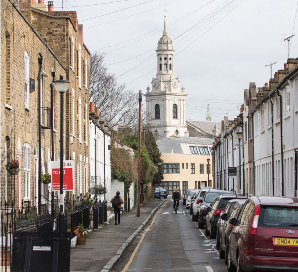
[The Glaisher Street sign has now gone, as has the temporary open space. It is no longer possible to see the backs of houses, the station or the 1865 Memorial Hall in Randall Place from here. The latter is a mission house built in 1865 by the London City Mission.]
From Straightsmouth we proceed under the railway and so to Greenwich High Road.
Immediately on the right are the buildings which were once part of Lovibonds Brewery. John Lovibond built his brewery in Greenwich High Road in 1865.
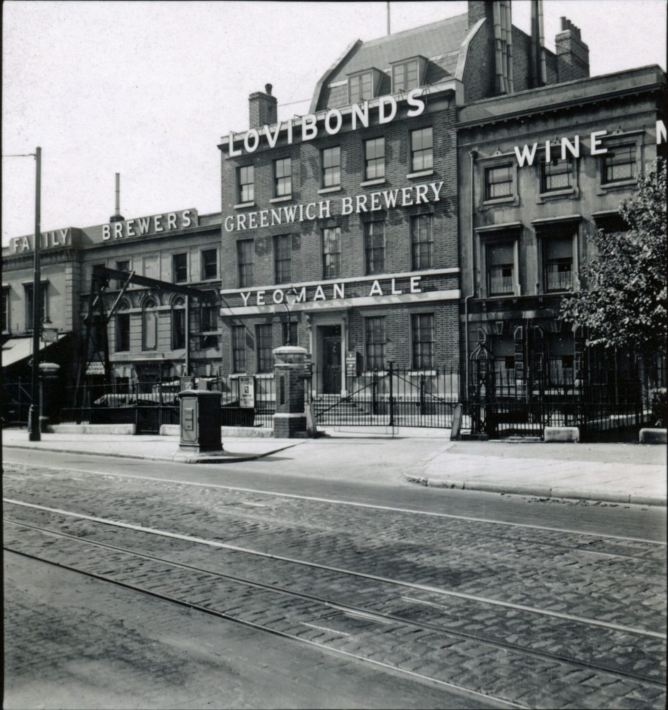
Photo by AR Martin c1937. RGHT.
[The tunnel under the railway has been relocated so the Lovibond buildings are now on the left]
No.169 Greenwich High Road. Early c18 house, exterior re-modelled early C19. This area was once called ‘Blue Stile.’
No.141 Greenwich High Road. The original Greenwich Town Hall, built 1876 (for the Greenwich District Board of Works), now West Greenwich Community Centre. Not on route of walk.
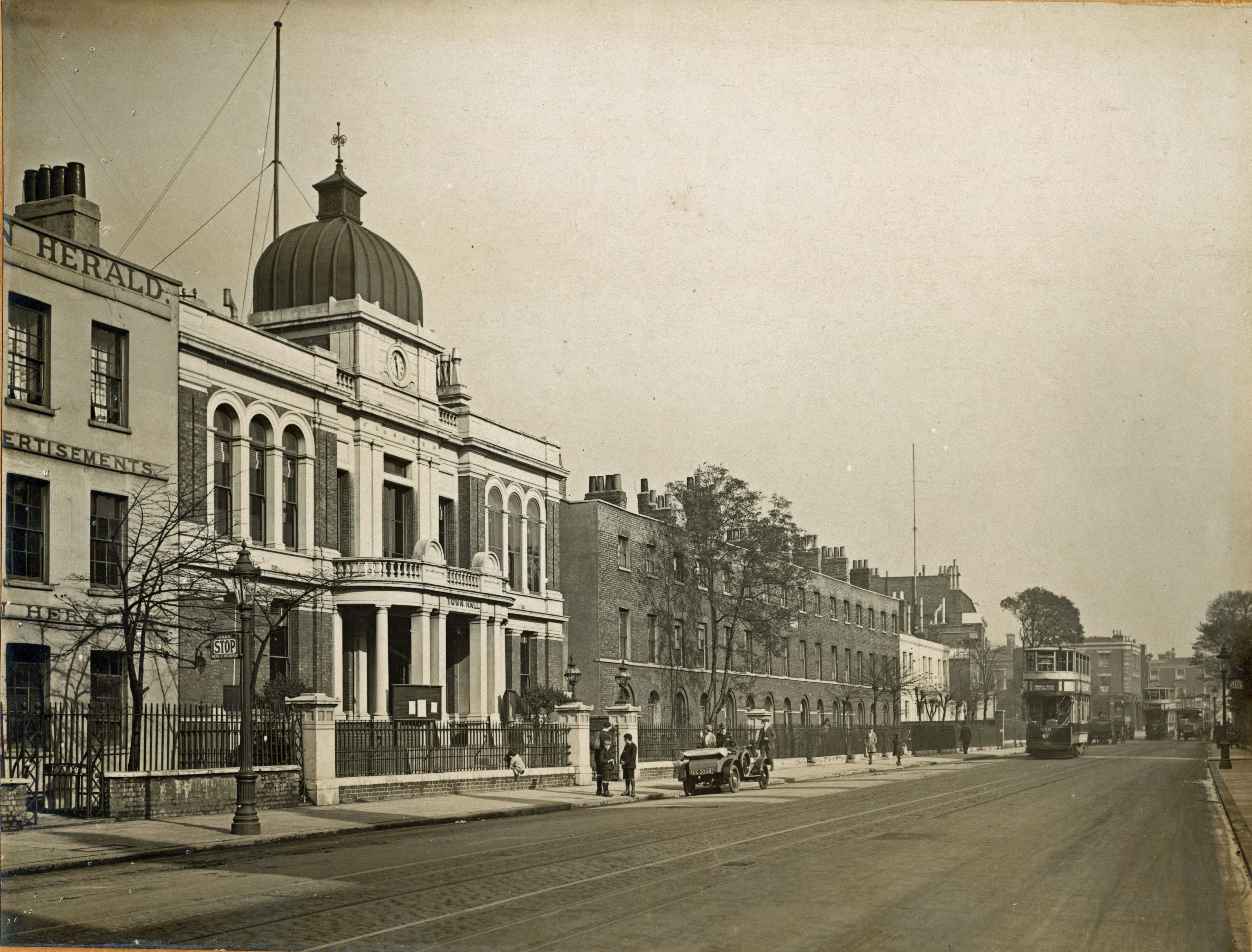
Adjoining is Vansittart Terrace, destroyed in World War II. RGHT.
Turn left into Greenwich High Road. Before walking to Greenwich Station look over the road to No. 136. Early C19 house. Now used by the Drapers Company.
Greenwich Station. First station built 1840. Architect George Smith of Blackheath.
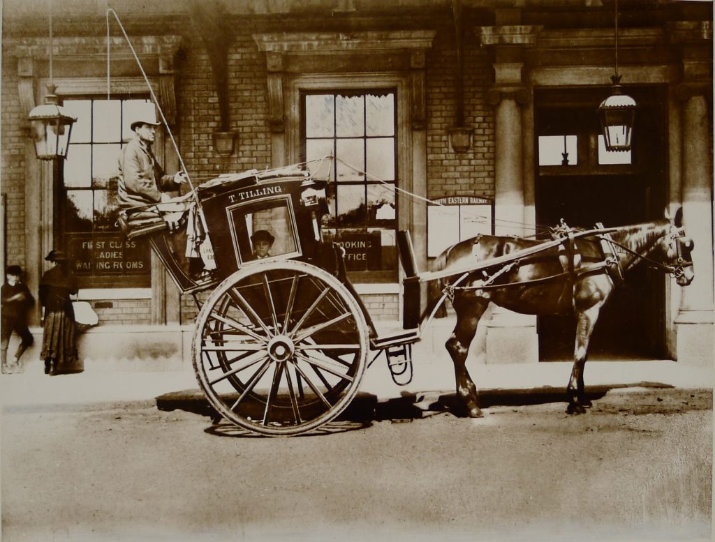
RL Sims photo for Revd Charles Spurgeon. RGHT.
The present station was built between 1876 and 1878 to replace the 1840 terminus. In the 1870s the line was extended to Maze Hill station so Greenwich station was moved back from Greenwich High Road, thus creating a forecourt. It is Italianate in style. In the forecourt is the Prince of Orange Public House. The building is C19 but there was a pub of this name on the site before the present building.
Opposite the station is Queen Elizabeths College, Founded by William Lambarde in 1576. The Tudor buildings were replaced by the present ones in 1817. The Chapel forms the centrepiece of the building.
Here Greenwich High Road has a junction with South Street, formerly Limekiln Lane. This junction is featured in Spurgeon’s photo entitled ‘Kentish Hay.’ The ornate lamp-post/drinking fountain has been replaced by a public lavatory.
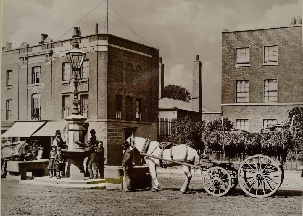
RL Sims photo for Revd Charles Spurgeon. RGHT.
South side
No. 144. Burdett House, a 3 storey Georgian building.
West Greenwich Library.
The second and now former Greenwich Town Hall, opened 1939. Designed by Culpin and Son. The tower is 165 feet high.
‘Morton’s Theatre’ stood on the western end of the town hall site.
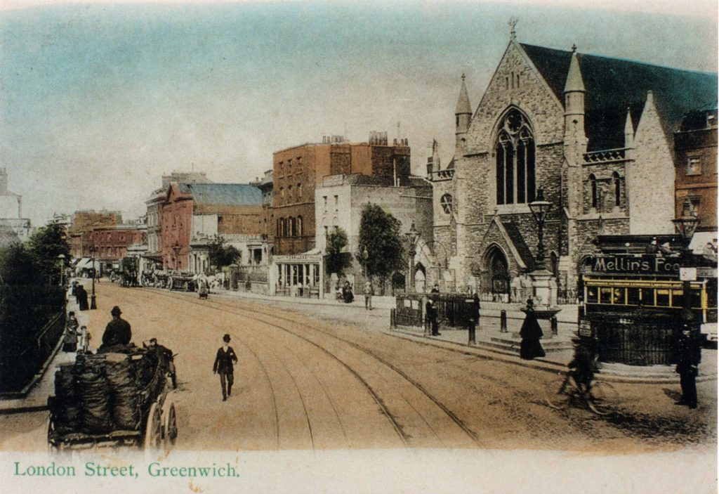
North side
Nos.199-213. Called ‘Bexley Place’ after Lord Bexley. Early C19.
From here the appearance of Greenwich High Road has changed since 1939. The tramlines have gone and many of the buildings were bombed or demolished. Some new building (north side) has been completed but the south side of the road awaits development. This allows a view of Stockwell Street, the Greenwich Theatre (1969) and Burney Street. Amongst the many buildings demolished in this area were Greenwich Park Station, and The White Hart Public House, both on Stockwell Street.
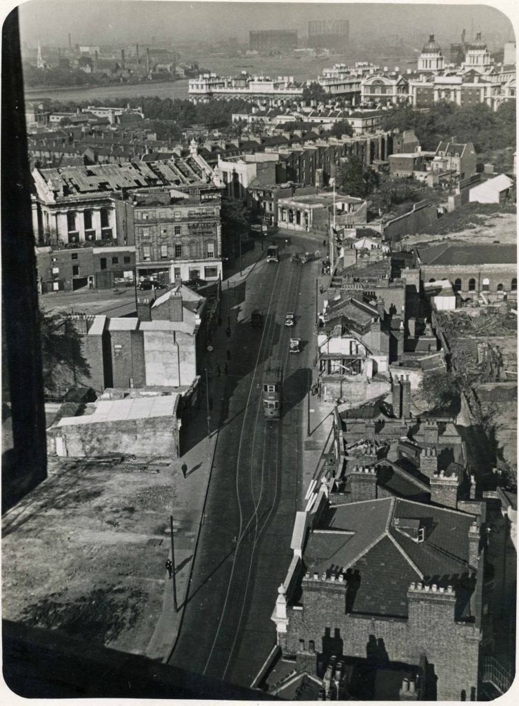
The walk ends by crossing the road to the Mitre Public House, the last building in Greenwich High Road. In 1829 the old Mitre tavern was destroyed by fire and the present building was erected in 1831.
Published by The Greenwich and Lewisham Antiquarian Society.
This makes a delicious walk.More please. Might it be time for a heavily illustrated book of rare Greenwich imagines?
Onwards